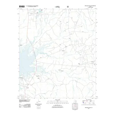
2010 Map of Pineland South
USGS Topo · Published 2010About this map
Pineland serves as the northern anchor of this East Texas survey, where the landscape transitions into a complex network of creeks and bayous. The topography is defined by the drainage of Curry Creek and Devils Ford Creek as they flow toward the southwestern marshlands near Brookeland. These wetlands are intersected by historical routes like Old Highway 8 N and Scrappin Valley Rd, reflecting the rural infrastructure that has supported local timber and agricultural interests for decades.
Find a feature on this map
59 named features on this map. Tap any name to fly to it.
Don’t see what you’re looking for? This feature index may not catch every label — zoom into the map to look around manually.
Map Details
Editions of this 2010 Pineland South Map
This is the sole edition of this map. No revisions or reprints were ever made.
Other maps of this area

1953 · Alexandria
USGS Topo · 1:250,000

1953 · Palestine
USGS Topo · 1:250,000

1955 · Alexandria
USGS Topo · 1:250,000

1957 · Palestine
USGS Topo · 1:250,000

1957 · Brookeland
USGS Topo · 1:62,500

1958 · Hemphill
USGS Topo · 1:62,500

1958 · Mc Gee Bend
USGS Topo · 1:62,500

1958 · Bronson
USGS Topo · 1:62,500

1969 · Brookeland
USGS Topo · 1:62,500
1984 · Harrisburg
USGS Topo · 1:24,000