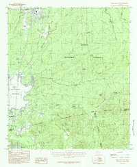
1984 Map of Pineland South
USGS Topo · Published 1984About this map
The timberlands and creek-threaded terrain of Deep East Texas take center stage in this mid-1980s provisional survey. Established within the Sabine National Forest, the landscape is defined by the expansive waters of the Sam Rayburn Reservoir along its western edge. Small settlements such as Pineland, Brookeland, and Browndell serve as local hubs, while smaller, informally named points like Stringtown and Stumptown reflect the rural settlement patterns typical of the region.
Find a feature on this map
38 named features on this map. Tap any name to fly to it.
Don’t see what you’re looking for? This feature index may not catch every label — zoom into the map to look around manually.
Map Details
Editions of this 1984 Pineland South Map
This is the sole edition of this map. No revisions or reprints were ever made.
Other maps of this area

1953 · Alexandria
USGS Topo · 1:250,000

1953 · Palestine
USGS Topo · 1:250,000

1955 · Alexandria
USGS Topo · 1:250,000

1957 · Palestine
USGS Topo · 1:250,000

1957 · Brookeland
USGS Topo · 1:62,500

1958 · Hemphill
USGS Topo · 1:62,500

1958 · Mc Gee Bend
USGS Topo · 1:62,500

1958 · Bronson
USGS Topo · 1:62,500

1969 · Brookeland
USGS Topo · 1:62,500
1984 · Harrisburg
USGS Topo · 1:24,000