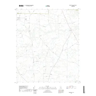
2020 Map of Pineview East
USGS Topo · Published 2020About this map
Pineview sits at the northwestern edge of this landscape, where the street grid of Warren St and E Commerce St meets the rural expanse of northern Wilcox County. The area is defined by a traditional agricultural and timber pattern, with family and community landmarks such as Christian Hill Cem and Liberty Hill Cem scattered across the drainage basins of Cedar Creek and Brushy Cr. The map reveals the local infrastructure of the modern era, notably the S&S Flying Service Airport positioned just east of the main town site. Beyond the residential clusters, a network of county roads like Christian Hill Rd and Cannonville Rd connects isolated homesteads and burial grounds, including the Dennard Cem and Cedar Creek Cem, providing a detailed look at the geographic distribution of long-standing local families near the boundary with Pulaski County.
Find a feature on this map
64 named features on this map. Tap any name to fly to it.
Don’t see what you’re looking for? This feature index may not catch every label — zoom into the map to look around manually.
Map Details
Editions of this 2020 Pineview East Map
This is the sole edition of this map. No revisions or reprints were ever made.
Other maps of this area

1953 · Waycross
USGS Topo · 1:250,000

1957 · Macon
USGS Topo · 1:250,000

1958 · Macon
USGS Topo · 1:250,000

1958 · Waycross
USGS Topo · 1:250,000

1964 · Macon
USGS Topo · 1:250,000

1971 · Pineview West
USGS Topo · 1:24,000

1972 · Finleyson East
USGS Topo · 1:24,000

1972 · West Of Eastman
USGS Topo · 1:24,000

1972 · Finleyson West
USGS Topo · 1:24,000

1972 · Abbeville North
USGS Topo · 1:24,000