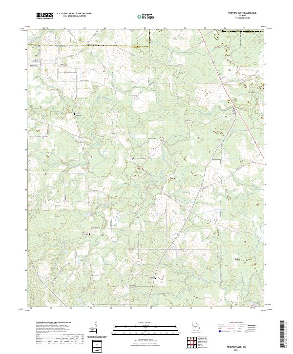
2024 Map of Pineview East
USGS Topo · Published 2024About this map
Pineview sits at the northwestern edge of this rural landscape where the border of Pulaski Co and Wilcox Co meets. The terrain is defined by the winding paths of Brushy Creek and Gum Creek, which carve through a network of local roads including Wiregrass Rd and Cannonville Rd. The area maintains a strong connection to its rural heritage, evidenced by numerous small family and community burial grounds such as Dennard Cem and Christian Hope Cem. The presence of the S&S Flying Service Airport near the town center indicates the continued importance of agricultural aviation in this part of Georgia. From Bluff Creek in the north to Folsom Creek in the south, the map documents a territory organized by long-established property lines and country routes like Christian Hill Rd.
Find a feature on this map
58 named features on this map. Tap any name to fly to it.
Don’t see what you’re looking for? This feature index may not catch every label — zoom into the map to look around manually.
Map Details
Editions of this 2024 Pineview East Map
This is the sole edition of this map. No revisions or reprints were ever made.
Other maps of this area

1953 · Waycross
USGS Topo · 1:250,000

1957 · Macon
USGS Topo · 1:250,000

1958 · Macon
USGS Topo · 1:250,000

1958 · Waycross
USGS Topo · 1:250,000

1964 · Macon
USGS Topo · 1:250,000

1971 · Pineview West
USGS Topo · 1:24,000

1972 · Finleyson East
USGS Topo · 1:24,000

1972 · West Of Eastman
USGS Topo · 1:24,000

1972 · Finleyson West
USGS Topo · 1:24,000

1972 · Abbeville North
USGS Topo · 1:24,000