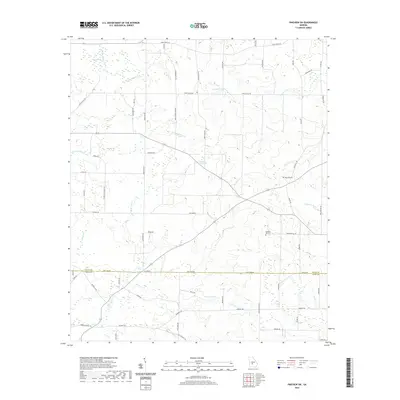
2020 Map of Pineview SW
USGS Topo · Published 2020About this map
Rock Hill Cem and Pleasant Hill Cem sit among the many agricultural roads and creek drainages that define this landscape along the border of Dooly and Crisp counties. The area is characterized by its complex hydrology, featuring the winding headwaters of the Alapaha River and the distinct geological presence of the Double Lime Sinks. Water dominates the geography, with tributaries like Sandy Mount Cr, Pennahatchee Cr, and Gum Cr threading through the countryside toward larger basins such as Sangster Lake and Brannon Lake.
Find a feature on this map
64 named features on this map. Tap any name to fly to it.
Don’t see what you’re looking for? This feature index may not catch every label — zoom into the map to look around manually.
Map Details
Editions of this 2020 Pineview SW Map
This is the sole edition of this map. No revisions or reprints were ever made.
Other maps of this area

1953 · Waycross
USGS Topo · 1:250,000

1957 · Macon
USGS Topo · 1:250,000

1958 · Macon
USGS Topo · 1:250,000

1958 · Waycross
USGS Topo · 1:250,000

1964 · Macon
USGS Topo · 1:250,000

1971 · Pineview West
USGS Topo · 1:24,000

1971 · Pineview NW
USGS Topo · 1:24,000

1971 · Pineview SW
USGS Topo · 1:24,000

1971 · Pinehurst
USGS Topo · 1:24,000

1972 · Finleyson West
USGS Topo · 1:24,000