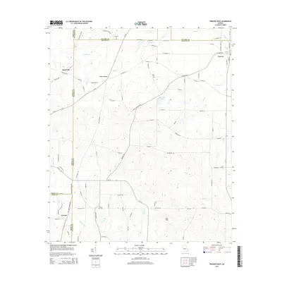
2014 Map of Pineview West
USGS Topo · Published 2014About this map
The Alapaha River begins its southward course in this region where the borders of Dooly, Pulaski, Wilcox, and Crisp counties converge. Centered on the town of Pineview, the landscape is defined by an extensive network of county roads and state routes like Ga-257, connecting small agricultural hubs such as Tippettville, Five Points, and Tremont. This rural section of central Georgia maintains deep family and community roots visible through numerous localized landmarks, including Pleasant View Cem, Friendship Cem, and Cook Cem. The topography is characterized by drainage systems like Tenmile Cr, Bluff Cr, and Bear Cr, which feed into larger water bodies such as Bloodworth Lake and Jones Lake. A notable high point in the southern portion of the quadrangle is the landform identified as High Rock, situated amidst a grid of rural lanes and timberland.
Find a feature on this map
91 named features on this map. Tap any name to fly to it.
Don’t see what you’re looking for? This feature index may not catch every label — zoom into the map to look around manually.
Map Details
Editions of this 2014 Pineview West Map
This is the sole edition of this map. No revisions or reprints were ever made.
Other maps of this area

1953 · Waycross
USGS Topo · 1:250,000

1957 · Macon
USGS Topo · 1:250,000

1958 · Macon
USGS Topo · 1:250,000

1958 · Waycross
USGS Topo · 1:250,000

1964 · Macon
USGS Topo · 1:250,000

1971 · Pineview West
USGS Topo · 1:24,000

1971 · Pineview NW
USGS Topo · 1:24,000

1971 · Pineview SW
USGS Topo · 1:24,000

1972 · Finleyson East
USGS Topo · 1:24,000

1972 · Finleyson West
USGS Topo · 1:24,000