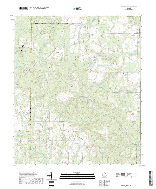
2024 Map of Pineview West
USGS Topo · Published 2024About this map
The Alapaha River winds through the southern reaches of this landscape, marking the intersection of Wilcox, Crisp, and Dooly counties. This agricultural and rural territory is anchored by the small settlements of Tippettville, Five Points, and the western outskirts of Pineview. The map reveals a dense network of county roads and family-named landmarks that speak to the region's genealogical depth, including numerous local burial grounds such as Tippettville Baptist Church Cem and Springhill Baptist Church Cem.
Find a feature on this map
91 named features on this map. Tap any name to fly to it.
Don’t see what you’re looking for? This feature index may not catch every label — zoom into the map to look around manually.
Map Details
Editions of this 2024 Pineview West Map
This is the sole edition of this map. No revisions or reprints were ever made.
Other maps of this area

1953 · Waycross
USGS Topo · 1:250,000

1957 · Macon
USGS Topo · 1:250,000

1958 · Macon
USGS Topo · 1:250,000

1958 · Waycross
USGS Topo · 1:250,000

1964 · Macon
USGS Topo · 1:250,000

1971 · Pineview West
USGS Topo · 1:24,000

1971 · Pineview NW
USGS Topo · 1:24,000

1971 · Pineview SW
USGS Topo · 1:24,000

1972 · Finleyson East
USGS Topo · 1:24,000

1972 · Finleyson West
USGS Topo · 1:24,000