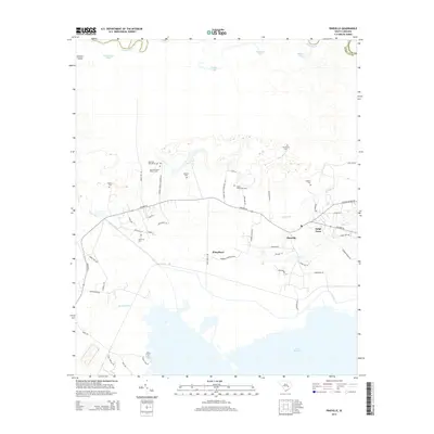
2014 Map of Pineville
USGS Topo · Published 2014About this map
Site of Francis Marion Tomb anchors the historical character of this Berkeley County landscape, marking the final resting place of the Revolutionary War hero known as the Swamp Fox. The terrain is defined by the transition from the Santee River in the north to the northern reaches of Lake Moultrie in the south. Between these waters, a network of plantation-era sites and small settlements like Pineville, Judge Town, and Lifeland are connected by Highway 45. Numerous burial grounds, including the Belle Isle Plantation Cem, Mahan Plantation Cem, and Mexico Cem, suggest a deep-rooted lineage of land ownership and residency. The presence of the Santee Canal and various oxbow lakes like Couturier Lake reflect a landscape heavily shaped by both natural river movements and 18th-century engineering efforts to connect the Santee and Cooper river systems.
Find a feature on this map
58 named features on this map. Tap any name to fly to it.
Don’t see what you’re looking for? This feature index may not catch every label — zoom into the map to look around manually.
Map Details
Editions of this 2014 Pineville Map
This is the sole edition of this map. No revisions or reprints were ever made.
Other maps of this area

1920 · Chicora
USGS Topo · 1:48,000

1920 · Manning
USGS Topo · 1:48,000

1921 · Chicora
USGS Topo · 1:62,500

1921 · Manning
USGS Topo · 1:62,500

1943 · Chicora
USGS Topo · 1:62,500

1943 · Bonneau
USGS Topo · 1:62,500

1944 · Manning
USGS Topo · 1:62,500

1946 · Kingstree
USGS Topo · 1:62,500

1949 · Georgetown
USGS Topo · 1:250,000

1954 · Augusta
USGS Topo · 1:250,000