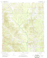
1968 Map of Pineville
USGS Topo · Published 1986About this map
Bienville National Forest dominates this landscape in northern Smith County during the late 1960s, where the winding course of the Leaf River meets numerous tributaries like Tallabogue Creek and Turkey Creek. The settlement of Pineville serves as a local anchor near the southern boundary, surrounded by established community landmarks such as Pineville Ch and Leaf River Ch. Evidence of earlier transport infrastructure is visible in the form of an Old Railroad Grade that cuts through the forested sections north of Tishkill Creek.
Find a feature on this map
21 named features on this map. Tap any name to fly to it.
Don’t see what you’re looking for? This feature index may not catch every label — zoom into the map to look around manually.
Map Details
Editions of this 1968 Pineville Map
2 editions found

Other maps of this area

1921 · Forest
USGS Topo · 1:48,000

1922 · Forest
USGS Topo · 1:62,500

1922 · Morton
USGS Topo · 1:48,000

1924 · Morton
USGS Topo · 1:62,500

1950 · Forest
USGS Topo · 1:62,500

1951 · Morton
USGS Topo · 1:62,500

1952 · Forest
USGS Topo · 1:62,500

1953 · Meridian
USGS Topo · 1:250,000

1957 · Meridian
USGS Topo · 1:250,000

1965 · Meridian
USGS Topo · 1:250,000