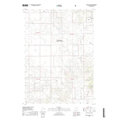
2018 Map of Piney Canyon SW
USGS Topo · Published 2018About this map
Thunder Basin National Grassland dominates this landscape in northeastern Wyoming, providing a detailed view of the public land management and natural drainage patterns in Campbell County. The terrain is defined by the Rochelle Hills to the southeast and the steep-walled Piney Canyon, where seasonal watercourses like Piney Cr and Beckwith Cr carve through the high plains. The map identifies specific water sources critical to this arid environment, including Hansen Spring and Red Spring, which historically supported ranching and transit across these ranges.
Find a feature on this map
18 named features on this map. Tap any name to fly to it.
Don’t see what you’re looking for? This feature index may not catch every label — zoom into the map to look around manually.
Map Details
Editions of this 2018 Piney Canyon SW Map
This is the sole edition of this map. No revisions or reprints were ever made.
Other maps of this area

1955 · Newcastle
USGS Topo · 1:250,000

1958 · Newcastle
USGS Topo · 1:250,000

1959 · Betty Reservoir
USGS Topo · 1:62,500

1971 · Fiddleback Ranch
USGS Topo · 1:24,000

1971 · Coal Bank Draw
USGS Topo · 1:24,000

1971 · Teckla
USGS Topo · 1:24,000

1971 · Piney Canyon NE
USGS Topo · 1:24,000

1971 · Reno Reservoir
USGS Topo · 1:24,000

1971 · Piney Canyon SW
USGS Topo · 1:24,000

1971 · Piney Canyon NW
USGS Topo · 1:24,000