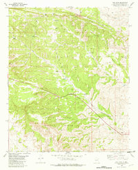
1982 Map of Pink Peak
USGS Topo · Published 1982About this map
White Sands Missile Range occupies the southern reaches of this high desert landscape, representing a significant military presence in Socorro County during the early 1980s. The terrain is dominated by the massive Chapadera Mesa, which is dissected by numerous drainages including Lutz Canyon and Taylor Canyon. These canyons provided natural corridors through the varied elevation, marked by prominent landmarks such as Pink Peak.
Find a feature on this map
27 named features on this map. Tap any name to fly to it.
Don’t see what you’re looking for? This feature index may not catch every label — zoom into the map to look around manually.
Map Details
Editions of this 1982 Pink Peak Map
This is the sole edition of this map. No revisions or reprints were ever made.
Other maps of this area

1918 · Oscura Peak
USGS Topo · 1:125,000

1948 · Broken Back Crater
USGS Topo · 1:62,500

1948 · Bingham
USGS Topo · 1:62,500

1948 · Chihuahua Ranch
USGS Topo · 1:62,500

1948 · Mockingbird Gap
USGS Topo · 1:62,500

1954 · Tularosa
USGS Topo · 1:250,000

1958 · Tularosa
USGS Topo · 1:250,000
1981 · Broken Back Crater
USGS Topo · 1:24,000
1981 · Cooper Canyon
USGS Topo · 1:24,000
1982 · Wagon Canyon
USGS Topo · 1:24,000