
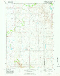
1981 Map of Pinnacle Rocks
USGS Topo · Published 1981About this map
Pinnacle Rocks and the distinctive Miller Buttes dominate this landscape on the border of Converse and Niobrara counties. The 1981 terrain is defined by a complex network of seasonal drainages, including Nachtman Draw, Sawmill Draw, and Archie Draw, which feed into larger watercourses like Cow Creek and Middle Creek. This area illustrates a typical Western ranching and resource landscape, where topographic features carry the names of early settlers or local landmarks like the Rattlesnake Hills.
Find a feature on this map
18 named features on this map. Tap any name to fly to it.
Don’t see what you’re looking for? This feature index may not catch every label — zoom into the map to look around manually.
Map Details
Editions of this 1981 Pinnacle Rocks Map
This is the sole edition of this map. No revisions or reprints were ever made.
Other maps of this area

1955 · Newcastle
USGS Topo · 1:250,000

1958 · Newcastle
USGS Topo · 1:250,000

1970 · Bill 4 NE
USGS Topo · 1:24,000

1971 · Fiddleback Ranch
USGS Topo · 1:24,000

1971 · Esau Spring
USGS Topo · 1:24,000

1979 · Bill
USGS Topo · 1:100,000

1981 · Calf Draw
USGS Topo · 1:24,000
1981 · Wagonhound Creek
USGS Topo · 1:24,000

1981 · Mercer Draw
USGS Topo · 1:24,000

1981 · Wagonhound Creek NE
USGS Topo · 1:24,000