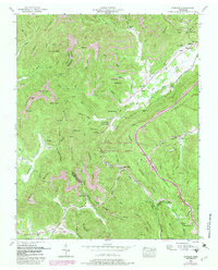
1952 Map of Pioneer
USGS Topo · Published 1980About this map
The Southern Railway winds through the heart of this Campbell County terrain, following the low-lying Elk Fork through a landscape defined by industrial extraction and small mountain communities. The settlement of Pioneer sits at the base of Limestone Ridge, while to the north, Elk Valley is supported by a cluster of social landmarks including Elk Fork Church, Valley View Church, and the Baird Cemetery. The map documents a period of active land use, with numerous Coal deposits and Strip Mines peppered across the slopes of Chimney Mountain and Braden Mountain. These mining operations sit alongside legacy institutions like the Lick Fork School and Straight Fork School, illustrating the complex social geography of the Tennessee coalfields during the mid-20th century. Large-scale conservation efforts are also evident in the extensive Koppers Wildlife Management Area covering much of the central ridges.
Find a feature on this map
89 named features on this map. Tap any name to fly to it.
Don’t see what you’re looking for? This feature index may not catch every label — zoom into the map to look around manually.
Map Details
Editions of this 1952 Pioneer Map
4 editions found
Other maps of this area

1890 · Williamsburg
USGS Topo · 1:125,000

1893 · Briceville
USGS Topo · 1:125,000

1894 · Williamsburg
USGS Topo · 1:125,000

1895 · Briceville
USGS Topo · 1:125,000

1896 · Briceville
USGS Topo · 1:125,000

1936 · Ivydell
USGS Topo · 1:24,000

1936 · Block
USGS Topo · 1:24,000

1936 · Jacksboro
USGS Topo · 1:24,000

1936 · Pioneer
USGS Topo · 1:24,000

1936 · La Follette
USGS Topo · 1:48,000