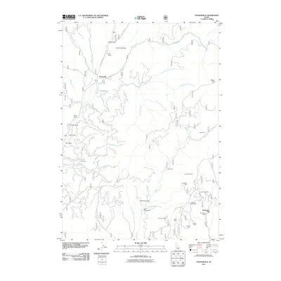
2011 Map of Pioneerville
USGS Topo · Published 2011About this map
Pioneerville sits as a primary landmark in this landscape of the Boise Basin, characterized by an extensive history of mining and ranching. The terrain is defined by complex drainages and gulches, including Miller Gulch, Hall Gulch, and the curiously named Lager Beer Gulch. This map provides a detailed look at the infrastructure of the local mineral economy, with numerous sites clustered in the southeast. Significant industrial locations like the Washington Mill and the Washington Mine are clearly marked, alongside other named operations such as the Gambrinus Mine and Elkhorn Mine. The geography also includes Arbaugh Ranch near Grimes Creek, illustrating the coexistence of agricultural and extractive land use. Numerous watercourses, from Little Muddy Creek to Ross Fork, weave through the steep elevations toward summits like Wilson Peak.
Find a feature on this map
50 named features on this map. Tap any name to fly to it.
Don’t see what you’re looking for? This feature index may not catch every label — zoom into the map to look around manually.
Map Details
Editions of this 2011 Pioneerville Map
This is the sole edition of this map. No revisions or reprints were ever made.
Other maps of this area

1894 · Idaho Basin
USGS Topo · 1:125,000

1909 · Garden Valley
USGS Topo · 1:125,000

1955 · Hailey
USGS Topo · 1:250,000

1957 · Placerville
USGS Topo · 1:24,000

1957 · Pioneerville
USGS Topo · 1:24,000

1957 · Warm Springs Point
USGS Topo · 1:24,000

1957 · Idaho City
USGS Topo · 1:24,000

1957 · Challis
USGS Topo · 1:250,000

1959 · Hailey
USGS Topo · 1:250,000

1959 · Garden Valley
USGS Topo · 1:62,500