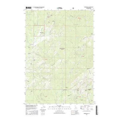
2017 Map of Pioneerville
USGS Topo · Published 2017About this map
Pioneerville sits within the heart of the Boise Basin, an area defined by its deep drainages and legacy of extraction within the Boise National Forest. The landscape is a network of ridges and gulches, where named features such as Miller Gulch, Hall Gulch, and Violet Gulch descend toward the central vein of Grimes Creek. This survey captures the specialized infrastructure of the region's historical industry, noting the location of the Washington Mill and the Mascot Mine near the southern boundary. Higher elevations are marked by prominent points like Wilson Peak and crossings such as Coulter Summit, while the rugged travel routes like the Henry Smith Whiskey Road and Summit Flat indicate how this difficult terrain was navigated for timber and mineral access in Boise County.
Find a feature on this map
70 named features on this map. Tap any name to fly to it.
Don’t see what you’re looking for? This feature index may not catch every label — zoom into the map to look around manually.
Map Details
Editions of this 2017 Pioneerville Map
This is the sole edition of this map. No revisions or reprints were ever made.
Other maps of this area

1894 · Idaho Basin
USGS Topo · 1:125,000

1909 · Garden Valley
USGS Topo · 1:125,000

1955 · Hailey
USGS Topo · 1:250,000

1957 · Placerville
USGS Topo · 1:24,000

1957 · Pioneerville
USGS Topo · 1:24,000

1957 · Warm Springs Point
USGS Topo · 1:24,000

1957 · Idaho City
USGS Topo · 1:24,000

1957 · Challis
USGS Topo · 1:250,000

1959 · Hailey
USGS Topo · 1:250,000

1959 · Garden Valley
USGS Topo · 1:62,500