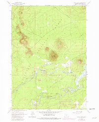
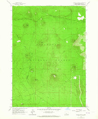
1963 Map of Pistol Butte
USGS Topo · Published 1981About this map
Volcanic peaks and riverine wetlands dominate this portion of the Deschutes National Forest as it appeared in the early 1960s. The landscape is defined by prominent buttes, including Wake Butte, Sitkum Butte, and the central Pistol Butte—which features a designated Lookout. To the south, the water systems of the Fall River and the meandering Deschutes River provide a sharp contrast to the cinder-strewn uplands. Human activity is concentrated along these waterways, evidenced by the Fall River Fish Hatchery, a nearby Gaging Station, and the Fall River Lodge. The presence of the Fall River Airfield and numerous Cinder Pit locations suggests an era of active forest management and local resource extraction. Further east, the Deschutes River winds toward The Dead Slough near the Foster Ranch, showing the varied hydrology of this high-elevation region.
Find a feature on this map
26 named features on this map. Tap any name to fly to it.
Don’t see what you’re looking for? This feature index may not catch every label — zoom into the map to look around manually.
Map Details
Editions of this 1963 Pistol Butte Map
3 editions found
Other maps of this area

1930 · Maiden Peak
USGS Topo · 1:125,000

1931 · Newberry Crater
USGS Topo · 1:125,000

1934 · Maiden Peak
USGS Topo · 1:125,000

1935 · Newberry Crater
USGS Topo · 1:125,000

1955 · Crescent
USGS Topo · 1:250,000

1957 · Crescent
USGS Topo · 1:250,000

1958 · Crescent
USGS Topo · 1:250,000

1963 · Round Mountain
USGS Topo · 1:24,000
1963 · Benham Falls
USGS Topo · 1:24,000
1963 · Wanoga Butte
USGS Topo · 1:24,000