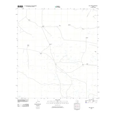
2010 Map of Pita Camp
USGS Topo · Published 2010About this map
Pita Camp sits at the heart of this coastal prairie landscape in Kenedy County, illustrating the specialized infrastructure of South Texas ranching in the early 21st century. The map is defined by an extensive network of namesake water sources, including Patron Windmill, Zacahuistle Windmill, and Golondrina Windmill, which are essential for livestock in this arid environment. These scattered landmarks, along with Ball Ranch and the Suman Gate, suggest a vast, open-range economy where navigation relies on specific improvements rather than dense settlement. The terrain is largely flat, broken only by subtle features like Ebony Hill, which serves as a natural marker in an otherwise uniform expanse of scrub and grassland. This survey captures the region's enduring character as a sparsely populated cattle-rearing district, where the distribution of windmills like Rita Windmill and Los Pobres Windmill provides a blueprint of land use and water management.
Find a feature on this map
13 named features on this map. Tap any name to fly to it.
Don’t see what you’re looking for? This feature index may not catch every label — zoom into the map to look around manually.
Map Details
Editions of this 2010 Pita Camp Map
This is the sole edition of this map. No revisions or reprints were ever made.
Other maps of this area

1921 · Falfurrias
USGS Topo · 1:125,000

1923 · Armstrong
USGS Topo · 1:62,500

1928 · Sarita
USGS Topo · 1:125,000

1949 · Mc Allen
USGS Topo · 1:250,000

1950 · Corpus Christi
USGS Topo · 1:250,000

1953 · Brownsville
USGS Topo · 1:250,000

1954 · McAllen
USGS Topo · 1:250,000

1954 · Sarita
USGS Topo · 1:62,500

1956 · Corpus Christi
USGS Topo · 1:250,000

1956 · Pita Camp
USGS Topo · 1:24,000