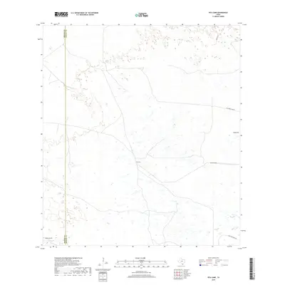
2019 Map of Pita Camp
USGS Topo · Published 2019About this map
Pita Camp sits at the heart of this coastal South Texas landscape, defined by a network of ranch roads and gates in the western reaches of Kenedy County. The area’s geography is marked by subtle rises like Ebony Hill and Quiteria Hill, overlooking small, scattered wetlands and Quiteria Lake. This 2019 survey documents a sparsely populated ranching environment along the boundary with Brooks County, where travel is facilitated by rural thoroughfares such as Los Pobres Camp Rd and Tobin Armstrong Rd. The presence of named access points like Suman Gate and specific routes like Turcotte W reflects the legacy of the region's large cattle ranching operations and the practical infrastructure required to manage these extensive private holdings.
Find a feature on this map
9 named features on this map. Tap any name to fly to it.
Don’t see what you’re looking for? This feature index may not catch every label — zoom into the map to look around manually.
Map Details
Editions of this 2019 Pita Camp Map
This is the sole edition of this map. No revisions or reprints were ever made.
Other maps of this area

1921 · Falfurrias
USGS Topo · 1:125,000

1923 · Armstrong
USGS Topo · 1:62,500

1928 · Sarita
USGS Topo · 1:125,000

1949 · Mc Allen
USGS Topo · 1:250,000

1950 · Corpus Christi
USGS Topo · 1:250,000

1953 · Brownsville
USGS Topo · 1:250,000

1954 · McAllen
USGS Topo · 1:250,000

1954 · Sarita
USGS Topo · 1:62,500

1956 · Corpus Christi
USGS Topo · 1:250,000

1956 · Pita Camp
USGS Topo · 1:24,000