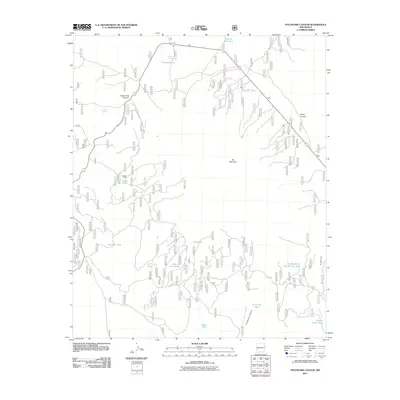
2011 Map of Pitchfork Canyon
USGS Topo · Published 2011About this map
Slater Cabin stands as a focal point for settlement in this high-altitude landscape of Catron County, New Mexico. The terrain is defined by a series of deep drainages and volcanic peaks, most notably Elk Mountain and the complex network of Pitchfork Canyon and Turkey Park Canyon. This 2011 survey reveals an environment where water management is critical for ranching and wildlife, as evidenced by a high density of named water catchments and reservoirs including Steve Tank, Double Barrel Number Two Tank, and Seven HL Tank. Access to these remote reaches is maintained by a system of forest roads, including FR 141 and S Elk Rd, which navigate the steep divide between Canyon Creek and Divide Canyon. The presence of Shantie Spring and Turkey Spring indicates the few natural permanent water sources in this arid, high-country territory.
Find a feature on this map
21 named features on this map. Tap any name to fly to it.
Don’t see what you’re looking for? This feature index may not catch every label — zoom into the map to look around manually.
Map Details
Editions of this 2011 Pitchfork Canyon Map
This is the sole edition of this map. No revisions or reprints were ever made.
Other maps of this area

1910 · Mogollon
USGS Topo · 1:125,000

1911 · Alum Mountain
USGS Topo · 1:125,000

1912 · Mogollon
USGS Topo · 1:125,000

1913 · Alum Mountain
USGS Topo · 1:125,000

1915 · Reserve
USGS Topo · 1:125,000

1918 · Pelona
USGS Topo · 1:125,000

1918 · Reserve
USGS Topo · 1:125,000

1954 · Clifton
USGS Topo · 1:250,000

1957 · Clifton
USGS Topo · 1:250,000

1958 · Clifton
USGS Topo · 1:250,000