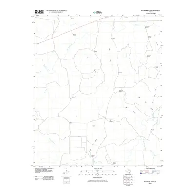
2010 Map of Pitchfork Flats
USGS Topo · Published 2010About this map
Pitchfork Flats characterizes this stretch of King County, where the ranching infrastructure of West Texas is documented through a dense network of water features. Named for the local terrain, this area is defined by its reliance on windmills for livestock, such as Krit Windmill, E Vat Windmill, and Owens Windmill. The landscape is carved by several major watercourses, including the South Wichita River and North Croton Creek, which are fed by numerous canyons like Lynn Canyon and Wall Canyon. High points such as Dog Town Mountain and Cedar Point provide landmarks across the flats, while the Texas No Name Number 20 Dam represents modern water management in this arid environment. The map provides a detailed view of the rural road network, with routes like Co RD 415 and Co RD 111 connecting isolated ranching outposts.
Find a feature on this map
39 named features on this map. Tap any name to fly to it.
Don’t see what you’re looking for? This feature index may not catch every label — zoom into the map to look around manually.
Map Details
Editions of this 2010 Pitchfork Flats Map
This is the sole edition of this map. No revisions or reprints were ever made.
Other maps of this area

1954 · Lubbock
USGS Topo · 1:250,000

1958 · Pursley House
USGS Topo · 1:24,000

1958 · Southerland Canyon
USGS Topo · 1:24,000

1959 · Bob Creek
USGS Topo · 1:24,000

1967 · Guthrie NW
USGS Topo · 1:24,000

1967 · Fourmile Hill
USGS Topo · 1:24,000

1968 · Pitchfork Ranch
USGS Topo · 1:24,000

1968 · Guthrie
USGS Topo · 1:24,000

1968 · East Afton NE
USGS Topo · 1:24,000

1968 · Pitchfork Flats
USGS Topo · 1:24,000