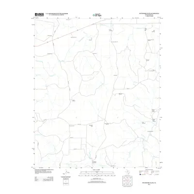
2012 Map of Pitchfork Flats
USGS Topo · Published 2012About this map
Pitchfork Flats occupies the heart of this ranching landscape in King County, characterized by a complex network of canyons and intermittent watercourses. The territory is defined by the S Wichita River in the north and N Croton Cr to the south, with the land between marked by family-named landmarks and essential water infrastructure. The distribution of features like the Dog Town Mountain Windmill, Hollywood Windmill, and Owens Windmill illustrates the vital role of groundwater management in this arid Texas environment. Topographical variety is found in the deep cuts of Lynn Canyon and F A Canyon, while the elevated Dog Town Mtn provides a prominent natural waypoint. A grid of county roads, including Co RD-212 and Co RD-415, connects these disparate points of activity across the plains.
Find a feature on this map
42 named features on this map. Tap any name to fly to it.
Don’t see what you’re looking for? This feature index may not catch every label — zoom into the map to look around manually.
Map Details
Editions of this 2012 Pitchfork Flats Map
This is the sole edition of this map. No revisions or reprints were ever made.
Other maps of this area

1954 · Lubbock
USGS Topo · 1:250,000

1958 · Pursley House
USGS Topo · 1:24,000

1958 · Southerland Canyon
USGS Topo · 1:24,000

1959 · Bob Creek
USGS Topo · 1:24,000

1967 · Guthrie NW
USGS Topo · 1:24,000

1967 · Fourmile Hill
USGS Topo · 1:24,000

1968 · Pitchfork Ranch
USGS Topo · 1:24,000

1968 · Guthrie
USGS Topo · 1:24,000

1968 · East Afton NE
USGS Topo · 1:24,000

1968 · Pitchfork Flats
USGS Topo · 1:24,000