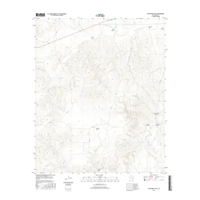
2016 Map of Pitchfork Flats
USGS Topo · Published 2016About this map
Pitchfork Flats and the surrounding drainage basins of the S Wichita River define this portion of the Texas Rolling Plains. The landscape is deeply incised by numerous canyons and hollows, including the prominent F A Canyon, Lynn Canyon, and Graves Hollow. This 2016 survey illustrates the remote character of King County, where a sparse network of county roads like Co RD 111 and Co RD 411 provides the only access across the rugged breaks. In the northeast, Dog Town Mtn rises above the river valley, while the southern reaches are marked by the headwaters of N Croton Cr and Rider Cr. The map captures a land focused on livestock and natural topography, with few permanent structures outside of the primary ranching flats and isolated canyon systems like Harper Young Canyon.
Find a feature on this map
21 named features on this map. Tap any name to fly to it.
Don’t see what you’re looking for? This feature index may not catch every label — zoom into the map to look around manually.
Map Details
Editions of this 2016 Pitchfork Flats Map
This is the sole edition of this map. No revisions or reprints were ever made.
Other maps of this area

1954 · Lubbock
USGS Topo · 1:250,000

1958 · Pursley House
USGS Topo · 1:24,000

1958 · Southerland Canyon
USGS Topo · 1:24,000

1959 · Bob Creek
USGS Topo · 1:24,000

1967 · Guthrie NW
USGS Topo · 1:24,000

1967 · Fourmile Hill
USGS Topo · 1:24,000

1968 · Pitchfork Ranch
USGS Topo · 1:24,000

1968 · Guthrie
USGS Topo · 1:24,000

1968 · East Afton NE
USGS Topo · 1:24,000

1968 · Pitchfork Flats
USGS Topo · 1:24,000