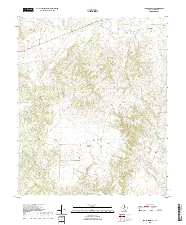
2022 Map of Pitchfork Flats
USGS Topo · Published 2022About this map
Pitchfork Flats serves as the central landmark for this West Texas landscape in King County. The terrain is defined by a dense network of drainages and dramatic elevation changes, where the S Wichita River and N Croton Cr carve through the earth. Numerous named topographic features illustrate the local nomenclature of the region, including the prominent Dog Town Mtn and several deeply cut paths such as Cedar Point Canyon, Wall Canyon, and Harper Young Canyon. Grounded in ranching geography, the area is accessible by a series of local routes like Co RD 411 and Co RD 415 that navigate around landforms like Graves Hollow. This 2022 survey provides an exceptionally detailed record of the ephemeral watercourses and canyons that characterize this part of the Rolling Plains.
Find a feature on this map
24 named features on this map. Tap any name to fly to it.
Don’t see what you’re looking for? This feature index may not catch every label — zoom into the map to look around manually.
Map Details
Editions of this 2022 Pitchfork Flats Map
This is the sole edition of this map. No revisions or reprints were ever made.
Other maps of this area

1954 · Lubbock
USGS Topo · 1:250,000

1958 · Pursley House
USGS Topo · 1:24,000

1958 · Southerland Canyon
USGS Topo · 1:24,000

1959 · Bob Creek
USGS Topo · 1:24,000

1967 · Guthrie NW
USGS Topo · 1:24,000

1967 · Fourmile Hill
USGS Topo · 1:24,000

1968 · Pitchfork Ranch
USGS Topo · 1:24,000

1968 · Guthrie
USGS Topo · 1:24,000

1968 · East Afton NE
USGS Topo · 1:24,000

1968 · Pitchfork Flats
USGS Topo · 1:24,000