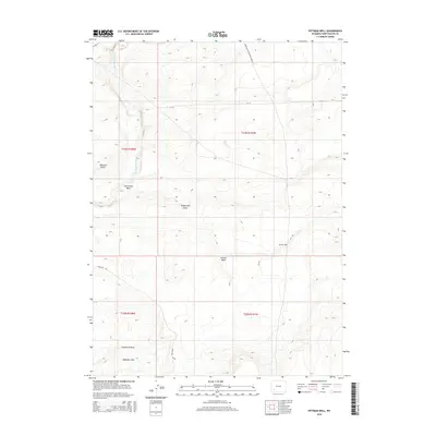
2015 Map of Pittman Well
USGS Topo · Published 2015About this map
The Green River-South Pass Stage Rd cuts through this high desert landscape, marking a corridor of historical travel across Sweetwater County. The terrain is defined by a network of drainage features like Starvation Wash, Stagecoach Draw, and Jensen Wash, which feed toward the Big Sandy River in the northwest. These arid washes and the prominent Badlands Hills illustrate the difficult environment navigated by early travelers and stage operators.
Find a feature on this map
15 named features on this map. Tap any name to fly to it.
Don’t see what you’re looking for? This feature index may not catch every label — zoom into the map to look around manually.
Map Details
Editions of this 2015 Pittman Well Map
This is the sole edition of this map. No revisions or reprints were ever made.
Other maps of this area

1954 · Rock Springs
USGS Topo · 1:250,000

1955 · Lander
USGS Topo · 1:250,000

1958 · Lander
USGS Topo · 1:250,000

1958 · Rock Springs
USGS Topo · 1:250,000

1961 · Lander
USGS Topo · 1:250,000

1962 · Rock Springs
USGS Topo · 1:250,000

1963 · Gasson Bridge
USGS Topo · 1:24,000

1963 · Pittman Well
USGS Topo · 1:24,000

1963 · Big Island Bridge
USGS Topo · 1:24,000
1963 · Chrisman Ranch
USGS Topo · 1:24,000