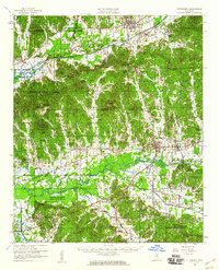
1954 Map of Pittsboro
USGS Topo · Published 1960About this map
The Yalobusha River and Skuna River converge into the newly formed Grenada Reservoir in this mid-century survey of Calhoun County. The landscape is defined by its deep spiritual and educational roots, featuring numerous community landmarks such as Zion Springs Ch & Cem, Warford Ch & Sch, and the Chapel Hill Ch & Tab. These institutions serve as the primary anchors for rural life between the larger hubs of Bruce, Calhoun City, and the county seat of Pittsboro.
Find a feature on this map
81 named features on this map. Tap any name to fly to it.
Don’t see what you’re looking for? This feature index may not catch every label — zoom into the map to look around manually.
Map Details
Editions of this 1954 Pittsboro Map
3 editions found
Other maps of this area

1953 · Walthall
USGS Topo · 1:62,500

1953 · West Point
USGS Topo · 1:250,000

1954 · Pittsboro
USGS Topo · 1:62,500

1954 · Duck Hill
USGS Topo · 1:62,500

1954 · Water Valley
USGS Topo · 1:62,500

1955 · Water Valley
USGS Topo · 1:62,500

1955 · Coffeeville
USGS Topo · 1:62,500

1956 · Tupelo
USGS Topo · 1:250,000

1958 · Tupelo
USGS Topo · 1:250,000

1958 · West Point
USGS Topo · 1:250,000