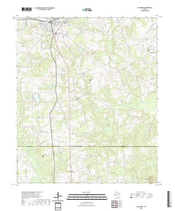
2022 Map of Pittsburg
USGS Topo · Published 2022About this map
The Camp County Courthouse serves as the focal point for the city of Pittsburg, where a dense network of streets like S Greer Blvd and Jefferson St transitions into the creek-fed lowlands of East Texas. This survey captures a landscape defined by its small, dispersed communities such as Pine, Ebenezer, and Union Ridge, many of which are anchored by family and community burial grounds. Numerous family-named cemeteries, including Smart Cem and Bolton Cem, are scattered across the terrain, offering significant data points for genealogical research. The geography is intricately carved by several waterways, most notably Prairie Cr, Dry Cr, and Little Cr, which drain the varied topography. In the southern portion of the sheet, the Camp Co Upshur Co boundary line runs through rural stretches populated by landmarks like Willow Oak Cem and the prominent Howell Mtn.
Find a feature on this map
119 named features on this map. Tap any name to fly to it.
Don’t see what you’re looking for? This feature index may not catch every label — zoom into the map to look around manually.
Map Details
Editions of this 2022 Pittsburg Map
This is the sole edition of this map. No revisions or reprints were ever made.
Other maps of this area

1953 · Texarkana
USGS Topo · 1:250,000

1956 · Texarkana
USGS Topo · 1:250,000

1956 · Tyler
USGS Topo · 1:250,000

1960 · Bettie
USGS Topo · 1:24,000

1960 · Thomas
USGS Topo · 1:24,000

1960 · Leesburg
USGS Topo · 1:24,000

1960 · Coffeeville
USGS Topo · 1:24,000

1960 · La Fayette
USGS Topo · 1:24,000

1960 · Pittsburg
USGS Topo · 1:24,000

1964 · Harvard
USGS Topo · 1:24,000