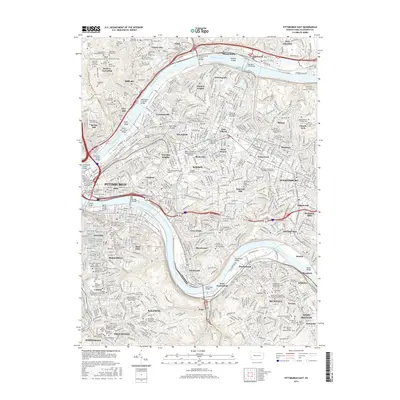
2016 Map of Pittsburgh East
USGS Topo · Published 2016About this map
The Allegheny River and Monongahela River define the industrial and residential heart of this Pittsburgh region, where steep hillsides are densely packed with historic neighborhoods and massive urban cemeteries. The landscape is a complex network of elevations, from the low-lying Soho and Lawrenceville riverfronts to the heights of Schenley Heights and Squirrel Hill. This 2016 record shows the heavy concentrations of religious and educational institutions that have long anchored these communities, including Duquesne Univ, Carlow Univ, and the sprawling University of Pittsburgh-Pittsburgh Campus. A remarkable density of burial grounds like the historic Allegheny Cemetery and Homewood Cemetery reflects the city's multi-generational heritage and ethnic diversity, while a vast bridge network including the Liberty Bridge and Washington Crossing Bridge illustrates the city's triumph over its challenging topography.
Find a feature on this map
143 named features on this map. Tap any name to fly to it.
Don’t see what you’re looking for? This feature index may not catch every label — zoom into the map to look around manually.
Map Details
Editions of this 2016 Pittsburgh East Map
This is the sole edition of this map. No revisions or reprints were ever made.
Other maps of this area

1904 · Mc Keesport
USGS Topo · 1:62,500

1904 · Carnegie
USGS Topo · 1:62,500

1906 · Carnegie
USGS Topo · 1:62,500

1906 · Sewickley
USGS Topo · 1:62,500

1907 · Pittsburg
USGS Topo · 1:62,500

1908 · Sewickley
USGS Topo · 1:62,500

1908 · Carnegie
USGS Topo · 1:62,500

1908 · New Kensington
USGS Topo · 1:62,500

1910 · New Kensington
USGS Topo · 1:62,500

1948 · Pittsburgh West
USGS Topo · 1:24,000