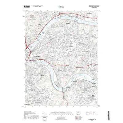
2019 Map of Pittsburgh East
USGS Topo · Published 2019About this map
The Allegheny River and Monongahela River converge to define this urban landscape, where the industrial and cultural heart of Pittsburgh is mapped in meticulous detail. The dense neighborhood fabric spans from the steep slopes of Troy Hill and Spring Hill to the expansive educational corridors of Oakland, Bellefield, and Shadyside. Large institutional landmarks are central to the map's character, including the sprawling grounds of Carnegie Mellon University and the University of Pittsburgh, alongside the distinctive Allegheny County Courthouse.
Find a feature on this map
131 named features on this map. Tap any name to fly to it.
Don’t see what you’re looking for? This feature index may not catch every label — zoom into the map to look around manually.
Map Details
Editions of this 2019 Pittsburgh East Map
This is the sole edition of this map. No revisions or reprints were ever made.
Other maps of this area

1904 · Mc Keesport
USGS Topo · 1:62,500

1904 · Carnegie
USGS Topo · 1:62,500

1906 · Carnegie
USGS Topo · 1:62,500

1906 · Sewickley
USGS Topo · 1:62,500

1907 · Pittsburg
USGS Topo · 1:62,500

1908 · Sewickley
USGS Topo · 1:62,500

1908 · Carnegie
USGS Topo · 1:62,500

1908 · New Kensington
USGS Topo · 1:62,500

1910 · New Kensington
USGS Topo · 1:62,500

1948 · Pittsburgh West
USGS Topo · 1:24,000