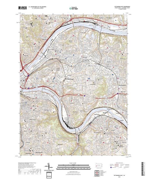
2023 Map of Pittsburgh East
USGS Topo · Published 2023About this map
The Monongahela River and Allegheny River converge toward the heart of Pittsburgh, framing a landscape defined by dense urban neighborhoods and historic riverfront industry. The map captures the complex topography of the city's east end, from the heights of Stanton Heights and Schenley Heights down to the riverbanks at Hazelwood and Lawrenceville. This modern survey documents an extraordinary density of religious and cultural landmarks, including the Saint Paul of the Cross Monastery and the Pittsburgh Theological Seminary.
Find a feature on this map
134 named features on this map. Tap any name to fly to it.
Don’t see what you’re looking for? This feature index may not catch every label — zoom into the map to look around manually.
Map Details
Editions of this 2023 Pittsburgh East Map
This is the sole edition of this map. No revisions or reprints were ever made.
Other maps of this area

1904 · Mc Keesport
USGS Topo · 1:62,500

1904 · Carnegie
USGS Topo · 1:62,500

1906 · Carnegie
USGS Topo · 1:62,500

1906 · Sewickley
USGS Topo · 1:62,500

1907 · Pittsburg
USGS Topo · 1:62,500

1908 · Sewickley
USGS Topo · 1:62,500

1908 · Carnegie
USGS Topo · 1:62,500

1908 · New Kensington
USGS Topo · 1:62,500

1910 · New Kensington
USGS Topo · 1:62,500

1948 · Pittsburgh West
USGS Topo · 1:24,000