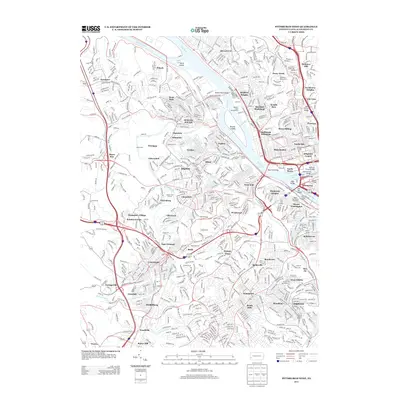
2013 Map of Pittsburgh West
USGS Topo · Published 2013About this map
The Ohio River carves through the heart of this urban landscape, defining the character of industrial and residential districts from McKees Rocks to the Downtown point. On the river’s north bank, the Western State Penitentiary and the Allegheny Observatory in Perry North anchor a densely developed area of historic neighborhoods like Manchester and Brighton Heights. The convergence of the Allegheny River and Monongahela River forms the famous apex at the North Shore, where massive engineering feats like the Fort Pitt Bridge and West End Bridge facilitate movement across the water.
Find a feature on this map
75 named features on this map. Tap any name to fly to it.
Don’t see what you’re looking for? This feature index may not catch every label — zoom into the map to look around manually.
Map Details
Editions of this 2013 Pittsburgh West Map
This is the sole edition of this map. No revisions or reprints were ever made.
Other maps of this area

1904 · Mc Keesport
USGS Topo · 1:62,500

1904 · Carnegie
USGS Topo · 1:62,500

1906 · Carnegie
USGS Topo · 1:62,500

1906 · Sewickley
USGS Topo · 1:62,500

1907 · Pittsburg
USGS Topo · 1:62,500

1908 · Sewickley
USGS Topo · 1:62,500

1908 · Carnegie
USGS Topo · 1:62,500

1908 · New Kensington
USGS Topo · 1:62,500

1910 · New Kensington
USGS Topo · 1:62,500

1948 · Pittsburgh West
USGS Topo · 1:24,000