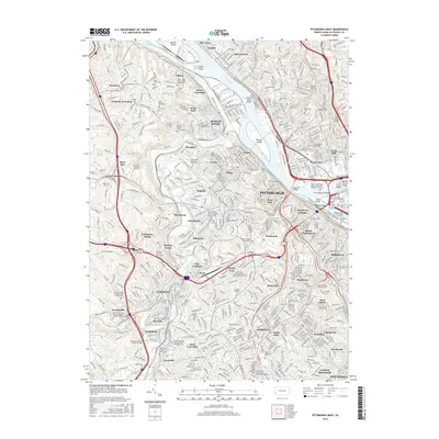
2016 Map of Pittsburgh West
USGS Topo · Published 2016About this map
Neville Island and Davis Island sit prominently in the Ohio River as it winds northwest from the confluence of the Allegheny River. This urban and industrial landscape is defined by its complex transportation network, including the Liberty Tunnel, Fort Pitt Tunnel, and a series of iconic river crossings like the McKees Rocks Bridge and Fort Duquesne Bridge. The map reveals a dense fabric of ethnic and religious heritage, particularly evident in the numerous specialized burial grounds such as the Polish Holy Trinity Polish National Cem, Beth Hamedrash Hagodal Cem, and Saint Marys Holy Virgin Russian Orthodox Church Cem. From the heights of Mount Washington to the suburban valleys of Scott Township, the terrain is marked by steep grades and the winding courses of Chartiers Creek and Saw Mill Run.
Find a feature on this map
104 named features on this map. Tap any name to fly to it.
Don’t see what you’re looking for? This feature index may not catch every label — zoom into the map to look around manually.
Map Details
Editions of this 2016 Pittsburgh West Map
This is the sole edition of this map. No revisions or reprints were ever made.
Other maps of this area

1904 · Mc Keesport
USGS Topo · 1:62,500

1904 · Carnegie
USGS Topo · 1:62,500

1906 · Carnegie
USGS Topo · 1:62,500

1906 · Sewickley
USGS Topo · 1:62,500

1907 · Pittsburg
USGS Topo · 1:62,500

1908 · Sewickley
USGS Topo · 1:62,500

1908 · Carnegie
USGS Topo · 1:62,500

1908 · New Kensington
USGS Topo · 1:62,500

1910 · New Kensington
USGS Topo · 1:62,500

1948 · Pittsburgh West
USGS Topo · 1:24,000