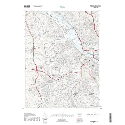
2019 Map of Pittsburgh West
USGS Topo · Published 2019About this map
Neville Island and the Ohio River corridor define this 2019 look at the industrial and residential heart of Western Pennsylvania. The map highlights a dense network of neighborhoods including Bellevue, McKees Rocks, and Sheraden, linked by significant river crossings like the McKees Rocks Bridge and West End Bridge. For genealogists, the sheet is exceptionally rich in religious and burial records, detailing sites such as Saint Phillips Roman Catholic Church Cem, the Polish Holy Trinity Polish National Cem, and the specialized Byzantine Catholic Seminary of Saints Cyril and Methodius. Institutional landmarks like the Woodville State Hospital Cem and Ohio Valley Hospital School of Nursing reflect the long-standing civic infrastructure of Allegheny County. From the heights of Mount Washington to the valley of Chartiers Creek, the survey documents the modern topography of a major American city and its inner-ring suburbs.
Find a feature on this map
95 named features on this map. Tap any name to fly to it.
Don’t see what you’re looking for? This feature index may not catch every label — zoom into the map to look around manually.
Map Details
Editions of this 2019 Pittsburgh West Map
This is the sole edition of this map. No revisions or reprints were ever made.
Other maps of this area

1904 · Mc Keesport
USGS Topo · 1:62,500

1904 · Carnegie
USGS Topo · 1:62,500

1906 · Carnegie
USGS Topo · 1:62,500

1906 · Sewickley
USGS Topo · 1:62,500

1907 · Pittsburg
USGS Topo · 1:62,500

1908 · Sewickley
USGS Topo · 1:62,500

1908 · Carnegie
USGS Topo · 1:62,500

1908 · New Kensington
USGS Topo · 1:62,500

1910 · New Kensington
USGS Topo · 1:62,500

1948 · Pittsburgh West
USGS Topo · 1:24,000