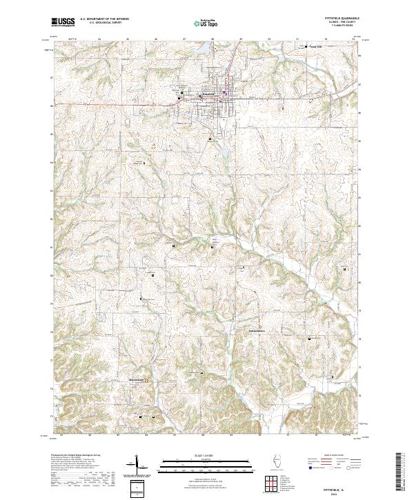
2024 Map of Pittsfield
USGS Topo · Published 2024About this map
The Pike County Courthouse stands as the central hub of this West Central Illinois landscape, anchoring the city of Pittsfield. As the county seat, the town is laid out on a systematic grid including streets like W Washington St and E Adams St, while the surrounding rural township is defined by its agrarian roots and family burial grounds. The map reveals a high density of small cemeteries scattered across the countryside, such as Tamsett Willsey Cem and Goodin Cem, which serve as vital markers for genealogical research in this region.
Find a feature on this map
65 named features on this map. Tap any name to fly to it.
Don’t see what you’re looking for? This feature index may not catch every label — zoom into the map to look around manually.
Map Details
Editions of this 2024 Pittsfield Map
This is the sole edition of this map. No revisions or reprints were ever made.
Historical Maps of Martinsburg Through Time
3 maps found