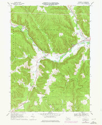
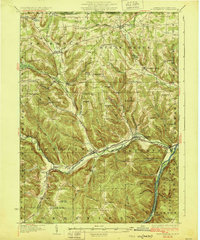
1968 Map of Pittsfield
USGS Topo · Published 1976About this map
Brokenstraw Creek serves as the primary corridor for development and transportation through this section of Warren County, following a valley where the Penn Central railroad connects the small settlements of Pittsfield and Garland. The 1968 field-check reveals a landscape where valley agriculture and light industry, indicated by various oil and gas wells, meet the vast wooded slopes of State Game Lands No 143. The map detail shows the essential infrastructure of local life, from the County Fairground near the creek to the Community Ch in the hamlet of Torpedo. Genealogists and local historians can trace the locations of family-named landmarks like Ross Hill Corners and established burial grounds such as Riverside Cem and Whitestown Cem. The map also documents the timber and recreational value of the area, featuring a Lookout Tower atop Cole Hill.
Find a feature on this map
44 named features on this map. Tap any name to fly to it.
Don’t see what you’re looking for? This feature index may not catch every label — zoom into the map to look around manually.
Map Details
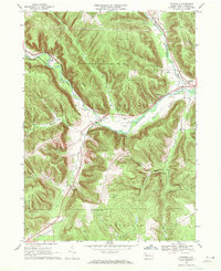
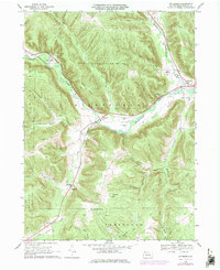
Editions of this 1968 Pittsfield Map
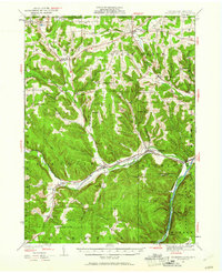
Other maps of this area
1926 · Youngsville
USGS Topo · 1:62,500

1927 · Tidioute
USGS Topo · 1:48,000

1927 · Titusville
USGS Topo · 1:62,500

1929 · Corry
USGS Topo · 1:48,000
1929 · Youngsville
USGS Topo · 1:62,500

1930 · Tidioute
USGS Topo · 1:62,500

1932 · Corry
USGS Topo · 1:62,500

1933 · Titusville
USGS Topo · 1:62,500
1943 · Youngsville
USGS Topo · 1:62,500

1957 · Warren
USGS Topo · 1:250,000
Featured Places
- Pittsfield Township, PA
- Spring Creek Township, PA
- Eldred Township, PA
- Deerfield Township, PA
- Torpedo, Pittsfield Township