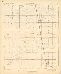
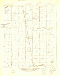
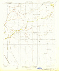
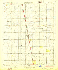
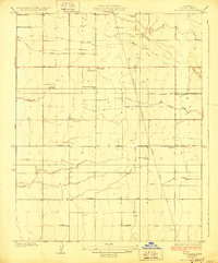
1929 Map of Pixley
USGS Topo · Published 1929About this map
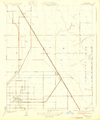
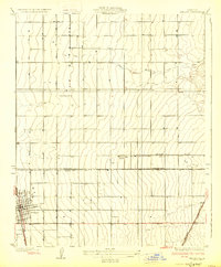
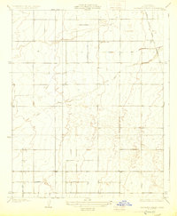
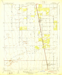
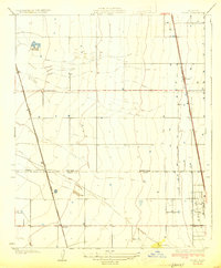
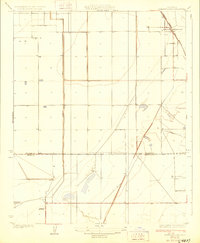
The Southern Pacific railroad corridor dictates the development of the Central Valley in this 1920s survey. Two primary settlements, Pixley and Earlimart, anchor the rail line, showing the early grid layouts and structures that supported the region's agricultural economy. The landscape is defined by the hydrologic patterns of Deer Creek and the Deer Creek Slough, which meander across the terrain north of the town sites.
Find a feature on this map
7 named features on this map. Tap any name to fly to it.
Don’t see what you’re looking for? This feature index may not catch every label — zoom into the map to look around manually.
Map Details
Editions of this 1929 Pixley Map
2 editions found
Other maps of this area
1925 · Tipton
USGS Topo · 1:31,680
1927 · Lake View School
USGS Topo · 1:31,680
1928 · Tipton
USGS Topo · 1:31,680
1928 · Woodville
USGS Topo · 1:31,680
1929 · Alpaugh
USGS Topo · 1:31,680
1929 · Delano
USGS Topo · 1:31,680
1929 · Sausalito School
USGS Topo · 1:31,680
1929 · Pixley
USGS Topo · 1:31,680
1929 · Stone
USGS Topo · 1:31,680
1929 · Allensworth
USGS Topo · 1:31,680