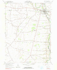
1961 Map of Plain City
USGS Topo · Published 1991About this map
Plain City serves as the focal point of this 1961 survey, situated at the junction of the Union and Madison county lines. The landscape is defined by the winding course of Big Darby Creek and its tributaries, including Sweeney Run and Sugar Run. The presence of the Pennsylvania RR and the Fairgrounds in the northeast corner highlights the town's role as a regional hub for transit and local commerce during the early 1960s.
Find a feature on this map
68 named features on this map. Tap any name to fly to it.
Don’t see what you’re looking for? This feature index may not catch every label — zoom into the map to look around manually.
Map Details
Editions of this 1961 Plain City Map
3 editions found
Other maps of this area

1901 · Dublin
USGS Topo · 1:62,500

1903 · Dublin
USGS Topo · 1:62,500

1907 · London
USGS Topo · 1:62,500

1916 · Milford Center
USGS Topo · 1:62,500

1923 · West Columbus
USGS Topo · 1:62,500

1925 · West Columbus
USGS Topo · 1:62,500

1944 · Milford Center
USGS Topo · 1:62,500

1947 · Columbus
USGS Topo · 1:250,000

1950 · Marion
USGS Topo · 1:250,000
1954 · Shawnee Hills
USGS Topo · 1:24,000