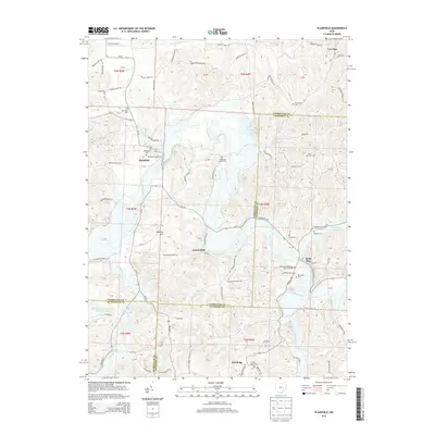
2013 Map of Plainfield
USGS Topo · Published 2013About this map
Wills Creek winds through a landscape defined by its overlapping county boundaries and rural hilltop settlements. This corner of eastern Ohio, where Coshocton, Guernsey, and Muskingum counties converge, is anchored by the village of Plainfield and the smaller hamlets of Linton Mills and Birds Run. The map reveals a dense network of family-named burial grounds, such as the Miskimen Family Cem and Schweitzer Cem, which speak to the long-standing agricultural roots of the area. Industrial history is etched into the terrain in the southwest, where the Peabody Coal Company Pond 0115-011 indicates the region's legacy of resource extraction. Aviation activity is noted at the Tri-City Airport in the northern reaches, while prominent landmarks like Roahrig Hill and Low Gap define the local topography surrounding the river valley.
Find a feature on this map
106 named features on this map. Tap any name to fly to it.
Don’t see what you’re looking for? This feature index may not catch every label — zoom into the map to look around manually.
Map Details
Editions of this 2013 Plainfield Map
This is the sole edition of this map. No revisions or reprints were ever made.
Other maps of this area

1908 · Conesville
USGS Topo · 1:62,500

1909 · Cambridge
USGS Topo · 1:62,500

1910 · Conesville
USGS Topo · 1:62,500

1911 · Newcomerstown
USGS Topo · 1:62,500

1912 · Cambridge
USGS Topo · 1:62,500

1913 · Newcomerstown
USGS Topo · 1:62,500

1913 · Coshocton
USGS Topo · 1:62,500

1915 · Coshocton
USGS Topo · 1:62,500

1943 · Coshocton
USGS Topo · 1:62,500

1943 · Newcomerstown
USGS Topo · 1:62,500