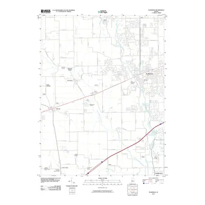
2010 Map of Plainfield
USGS Topo · Published 2010About this map
White Lick Creek and its various forks dictate the topography and development of this central Indiana landscape. The established community of Plainfield serves as a primary hub, while smaller surrounding settlements like Cartersburg, Belleville, and Joppa maintain their distinct rural character. The map is a significant resource for genealogists, documenting a high density of burial grounds including the Indiana Boy's School Cemetery, White Lick Friends Cemetery, and Salem Methodist Cemetery. The transition from historic routes like Old National Rd to a modern grid of county roads illustrates the area's evolution from a series of scattered hamlets into a more integrated suburban and agricultural corridor. The presence of Magnetic Springs and the Oaktree Golf Course highlights the region's diverse land use, balancing historical landmarks with recreational development.
Find a feature on this map
57 named features on this map. Tap any name to fly to it.
Don’t see what you’re looking for? This feature index may not catch every label — zoom into the map to look around manually.
Map Details
Editions of this 2010 Plainfield Map
This is the sole edition of this map. No revisions or reprints were ever made.
Other maps of this area

1953 · Bridgeport
USGS Topo · 1:24,000

1953 · Clayton
USGS Topo · 1:24,000

1953 · Danville
USGS Topo · 1:24,000

1953 · Brownsburg
USGS Topo · 1:24,000

1953 · Plainfield
USGS Topo · 1:24,000

1953 · Clermont
USGS Topo · 1:24,000

1953 · Indianapolis
USGS Topo · 1:250,000

1955 · Hall
USGS Topo · 1:24,000

1955 · Mooresville West
USGS Topo · 1:24,000

1955 · Mooresville East
USGS Topo · 1:24,000