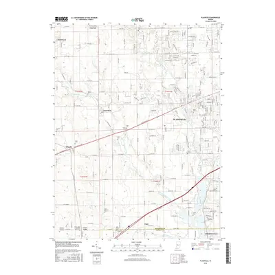
2016 Map of Plainfield
USGS Topo · Published 2016About this map
White Lick Creek and its various forks, including the West Fork White Lick Creek, carve a detailed drainage network across this portion of central Indiana. The town of Plainfield serves as the primary population center, situated along the historic route of the Old National Rd. The landscape reflects a transition from established residential developments to traditional agricultural tracts, particularly as one moves toward smaller communities like Cartersburg, Belleville, and Joppa.
Find a feature on this map
70 named features on this map. Tap any name to fly to it.
Don’t see what you’re looking for? This feature index may not catch every label — zoom into the map to look around manually.
Map Details
Editions of this 2016 Plainfield Map
This is the sole edition of this map. No revisions or reprints were ever made.
Other maps of this area

1953 · Bridgeport
USGS Topo · 1:24,000

1953 · Clayton
USGS Topo · 1:24,000

1953 · Danville
USGS Topo · 1:24,000

1953 · Brownsburg
USGS Topo · 1:24,000

1953 · Plainfield
USGS Topo · 1:24,000

1953 · Clermont
USGS Topo · 1:24,000

1953 · Indianapolis
USGS Topo · 1:250,000

1955 · Hall
USGS Topo · 1:24,000

1955 · Mooresville West
USGS Topo · 1:24,000

1955 · Mooresville East
USGS Topo · 1:24,000