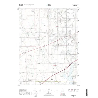
2019 Map of Plainfield
USGS Topo · Published 2019About this map
Plainfield and its surrounding suburban and rural landscapes are defined by the winding course of White Lick Creek and its major tributary, West Fork White Lick Creek. This 2019 survey documents the extensive residential development stretching between Avon and Plainfield, while the western and southern reaches of the map retain a more agricultural character. The area is notable for its numerous burial grounds, reflecting generations of local family history at sites like Maple Hill Cem, Sugar Grove Cem, and Irons Cem. Aviation is represented by the Hendricks County Airport-Gordon Graham Field in the northwest, serving as a regional hub. Small, long-standing communities such as Cartersburg, Belleville, and Joppa punctuate the grid of county roads, showing the persistent settlement pattern of Hendricks County and northern Morgan County.
Find a feature on this map
59 named features on this map. Tap any name to fly to it.
Don’t see what you’re looking for? This feature index may not catch every label — zoom into the map to look around manually.
Map Details
Editions of this 2019 Plainfield Map
This is the sole edition of this map. No revisions or reprints were ever made.
Other maps of this area

1953 · Bridgeport
USGS Topo · 1:24,000

1953 · Clayton
USGS Topo · 1:24,000

1953 · Danville
USGS Topo · 1:24,000

1953 · Brownsburg
USGS Topo · 1:24,000

1953 · Plainfield
USGS Topo · 1:24,000

1953 · Clermont
USGS Topo · 1:24,000

1953 · Indianapolis
USGS Topo · 1:250,000

1955 · Hall
USGS Topo · 1:24,000

1955 · Mooresville West
USGS Topo · 1:24,000

1955 · Mooresville East
USGS Topo · 1:24,000