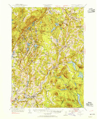
1953 Map of Plainfield
USGS Topo · Published 1954About this map
Plainfield and the upper reaches of the Winooski River anchor this mid-century survey of the Vermont highlands. The landscape is defined by a dense network of upland settlements and social institutions, including Goddard College and the landmark Old West Ch near Kents Cors. Industrial history is visible in the Granite Quarries near Woodbury and the infrastructure of the St Johnsbury and Lake Champlain RR, which served timber and stone interests through Walden Heights Walden Sta. The map records numerous neighborhood schools such as Pekin Sch and Houston Hill Sch, alongside many small rural burial grounds like Robinson Cem and Plains Cem. The terrain is punctuated by significant water bodies, notably Mollys Falls Pond and Groton Pond, which supported the region's early power and recreation needs while Marshfield stood as a key rail stop along the Montpelier River.
Find a feature on this map
146 named features on this map. Tap any name to fly to it.
Don’t see what you’re looking for? This feature index may not catch every label — zoom into the map to look around manually.
Map Details
Editions of this 1953 Plainfield Map
4 editions found
Other maps of this area

1919 · Montpelier
USGS Topo · 1:62,500

1921 · Montpelier
USGS Topo · 1:62,500

1922 · Barre
USGS Topo · 1:48,000

1924 · Barre
USGS Topo · 1:62,500

1927 · Hyde Park
USGS Topo · 1:48,000

1928 · Hardwick
USGS Topo · 1:62,500

1930 · Hyde Park
USGS Topo · 1:62,500

1931 · Woodsville
USGS Topo · 1:48,000

1934 · Hardwick
USGS Topo · 1:48,000

1935 · Woodsville
USGS Topo · 1:62,500