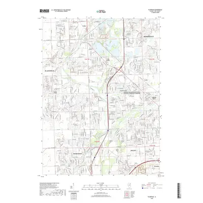
2018 Map of Plainfield
USGS Topo · Published 2018About this map
The DuPage River meanders through a landscape of suburban expansion and industrial history, connecting the communities of Plainfield and Joliet. This 2018 survey reveals the intricate development patterns of northern Illinois, where historical corridors like the Illinois and Michigan Canal National Heritage Corridor run parallel to modern infrastructure. Water features such as Lake Renwick, Legion Lake, and Puddle Pond provide central landmarks for the surrounding residential tracts.
Find a feature on this map
52 named features on this map. Tap any name to fly to it.
Don’t see what you’re looking for? This feature index may not catch every label — zoom into the map to look around manually.
Map Details
Editions of this 2018 Plainfield Map
This is the sole edition of this map. No revisions or reprints were ever made.
Other maps of this area

1892 · Morris
USGS Topo · 1:62,500

1892 · Joliet
USGS Topo · 1:62,500

1892 · Wilmington
USGS Topo · 1:62,500

1918 · Wilmington
USGS Topo · 1:62,500

1918 · Morris
USGS Topo · 1:62,500

1923 · Joliet
USGS Topo · 1:62,500

1925 · Yorkville
USGS Topo · 1:62,500

1953 · Yorkville SE
USGS Topo · 1:24,000
1953 · Normantown
USGS Topo · 1:24,000
1953 · Elwood
USGS Topo · 1:24,000