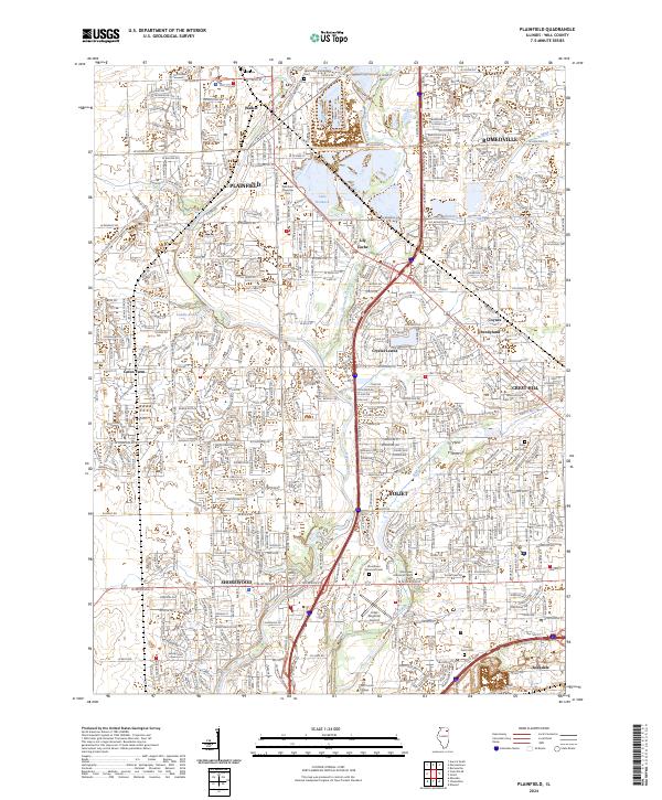
2024 Map of Plainfield
USGS Topo · Published 2024About this map
Plainfield and its surrounding suburban expansion are defined by the winding course of the Du Page River and the industrial corridors of the Will County heartland. This 2024 edition documents the modern landscape where historic settlements like Walker and Lily Cache meet contemporary developments. The map reveals a high density of civic and commemorative spaces, from the large Plainfield Township Cem to the sprawling Woodlawn Memorial Park I near the western edge of Joliet. Significant water bodies such as Lake Renwick and Legion Lake break the grid of arterial roads like W Lockport Rd and Caton Farm Rd. Transportation and education centers are also prominent, notably the Joliet Regional Airport and Joliet Junior College, which serve as landmarks in the evolving landscape between Shorewood and Crest Hill.
Find a feature on this map
56 named features on this map. Tap any name to fly to it.
Don’t see what you’re looking for? This feature index may not catch every label — zoom into the map to look around manually.
Map Details
Editions of this 2024 Plainfield Map
This is the sole edition of this map. No revisions or reprints were ever made.
Other maps of this area

1892 · Morris
USGS Topo · 1:62,500

1892 · Joliet
USGS Topo · 1:62,500

1892 · Wilmington
USGS Topo · 1:62,500

1918 · Wilmington
USGS Topo · 1:62,500

1918 · Morris
USGS Topo · 1:62,500

1923 · Joliet
USGS Topo · 1:62,500

1925 · Yorkville
USGS Topo · 1:62,500

1953 · Yorkville SE
USGS Topo · 1:24,000
1953 · Normantown
USGS Topo · 1:24,000
1953 · Elwood
USGS Topo · 1:24,000