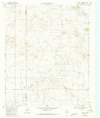
1969 Map of Plains 1 SE
USGS Topo · Published 1981About this map
The Prentice Gas Field dominates the southern half of this landscape, illustrating the intensive petroleum extraction character of the West Texas plains during the late 1960s. This industrial footprint is further defined by a complex network of pipelines and numerous oil wells that punctuate the terrain. The presence of a refinery and a radio tower near the border of Yoakum Co Terry Co highlights the infrastructure required to support the region's energy economy.
Find a feature on this map
14 named features on this map. Tap any name to fly to it.
Don’t see what you’re looking for? This feature index may not catch every label — zoom into the map to look around manually.
Map Details
Editions of this 1969 Plains 1 SE Map
Other maps of this area

1954 · Brownfield
USGS Topo · 1:250,000

1958 · Brownfield
USGS Topo · 1:250,000

1962 · Brownfield
USGS Topo · 1:250,000

1965 · Sundown
USGS Topo · 1:24,000

1965 · Plains 1 NE
USGS Topo · 1:24,000

1969 · Gomez
USGS Topo · 1:24,000

1969 · Plains 1 SE
USGS Topo · 1:24,000

1969 · Pool
USGS Topo · 1:24,000

1970 · Plains 1 SW
USGS Topo · 1:24,000

1970 · Tokio
USGS Topo · 1:24,000