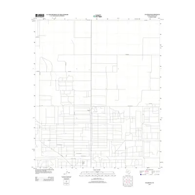
2012 Map of Plains SE
USGS Topo · Published 2012About this map
The Wasson Oil Field dominates this section of Yoakum County, illustrating the significant industrial footprint of petroleum extraction in the West Texas landscape. This 2012 survey reveals a geometric grid of access roads and infrastructure typical of the Permian Basin's energy-producing regions. The area is defined by a dense network of local thoroughfares, including Hudson Rd, Dixon Rd, and Ranch Road 213, which facilitate transit between extraction sites. Unique livestock management features are also noted, such as Cattle Guard 15, Cattle Guard 13, and Cattle Guard 9, marking the intersection of the region's ranching heritage with its modern industrial requirements. This layout highlights the evolution of land use in a region where wide-open ranching territory has been methodically subdivided for oil field development and transport.
Find a feature on this map
24 named features on this map. Tap any name to fly to it.
Don’t see what you’re looking for? This feature index may not catch every label — zoom into the map to look around manually.
Map Details
Editions of this 2012 Plains SE Map
This is the sole edition of this map. No revisions or reprints were ever made.
Other maps of this area

1954 · Hobbs
USGS Topo · 1:250,000

1954 · Brownfield
USGS Topo · 1:250,000

1958 · Brownfield
USGS Topo · 1:250,000

1958 · Hobbs
USGS Topo · 1:250,000

1962 · Brownfield
USGS Topo · 1:250,000

1970 · Tokio NW
USGS Topo · 1:24,000

1970 · Pleasant Hill
USGS Topo · 1:24,000

1970 · Seagraves NW
USGS Topo · 1:24,000

1971 · Plains NW
USGS Topo · 1:24,000

1971 · Higginbotham
USGS Topo · 1:24,000