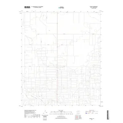
2019 Map of Plains SE
USGS Topo · Published 2019About this map
McKenzie Draw carves a subtle path across this portion of the South Plains, providing the primary topographical relief in an otherwise remarkably level agricultural landscape. This 2019 survey reflects the systematic grid of rural Yoakum County, where a network of county roads like Co Rd 300 and Hudson Rd partition the land into large parcels characteristic of West Texas ranching and cotton farming. State route 214 bisects the region vertically, acting as the primary transit corridor between local trade centers. The density of smaller access roads, such as Rd P-14, suggests intensive land use, likely related to the region's long-standing energy production or large-scale irrigation infrastructure. This map captures the modern industrial-agricultural character of the Llano Estacado, where human geometry is laid precisely over the high plains terrain.
Find a feature on this map
17 named features on this map. Tap any name to fly to it.
Don’t see what you’re looking for? This feature index may not catch every label — zoom into the map to look around manually.
Map Details
Editions of this 2019 Plains SE Map
This is the sole edition of this map. No revisions or reprints were ever made.
Other maps of this area

1954 · Hobbs
USGS Topo · 1:250,000

1954 · Brownfield
USGS Topo · 1:250,000

1958 · Brownfield
USGS Topo · 1:250,000

1958 · Hobbs
USGS Topo · 1:250,000

1962 · Brownfield
USGS Topo · 1:250,000

1970 · Tokio NW
USGS Topo · 1:24,000

1970 · Pleasant Hill
USGS Topo · 1:24,000

1970 · Seagraves NW
USGS Topo · 1:24,000

1971 · Plains NW
USGS Topo · 1:24,000

1971 · Higginbotham
USGS Topo · 1:24,000