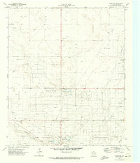
1971 Map of Plains SE
USGS Topo · Published 1973About this map
Industrial energy infrastructure and rural land management define this portion of Yoakum County during the early 1970s. The landscape is dominated by the extensive Wasson Oil Field and West Oil Field, featuring a dense network of wells, pipelines, and a central refinery. This intensive resource extraction is balanced by community spaces near the southern edge of the survey, including a County Park, Athletic Field, and a dedicated Rodeo Ground.
Find a feature on this map
17 named features on this map. Tap any name to fly to it.
Don’t see what you’re looking for? This feature index may not catch every label — zoom into the map to look around manually.
Map Details
Editions of this 1971 Plains SE Map
This is the sole edition of this map. No revisions or reprints were ever made.
Other maps of this area

1954 · Hobbs
USGS Topo · 1:250,000

1954 · Brownfield
USGS Topo · 1:250,000

1958 · Brownfield
USGS Topo · 1:250,000

1958 · Hobbs
USGS Topo · 1:250,000

1962 · Brownfield
USGS Topo · 1:250,000

1970 · Tokio NW
USGS Topo · 1:24,000

1970 · Pleasant Hill
USGS Topo · 1:24,000

1970 · Seagraves NW
USGS Topo · 1:24,000

1971 · Plains NW
USGS Topo · 1:24,000

1971 · Higginbotham
USGS Topo · 1:24,000