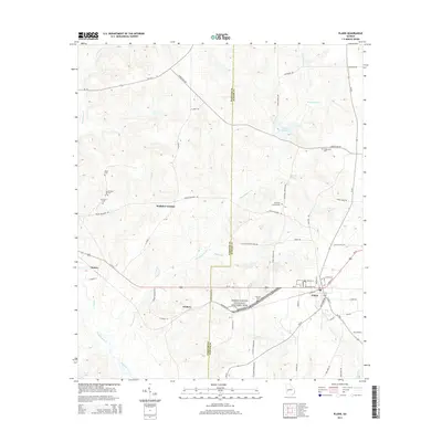
2014 Map of Plains
USGS Topo · Published 2014About this map
Plains and its surrounding countryside in southwestern Georgia are presented here at the transition between the Webster and Sumter county lines. This landscape is defined by its association with the 39th U.S. President, prominently featuring the Jimmy Carter National Historic Site and the nearby settlement of Archery, where the Carter family farm was located. The map documents the rural infrastructure of the early 21st century, from the primary corridor of Ga-27 to the many unpaved county roads that reach into the agricultural hinterlands.
Find a feature on this map
61 named features on this map. Tap any name to fly to it.
Don’t see what you’re looking for? This feature index may not catch every label — zoom into the map to look around manually.
Map Details
Editions of this 2014 Plains Map
This is the sole edition of this map. No revisions or reprints were ever made.
Other maps of this area

1953 · Dothan
USGS Topo · 1:250,000

1954 · Dothan
USGS Topo · 1:250,000

1955 · Dothan
USGS Topo · 1:250,000

1955 · Phenix City
USGS Topo · 1:250,000

1957 · Phenix City
USGS Topo · 1:250,000

1958 · Phenix City
USGS Topo · 1:250,000
1972 · Preston
USGS Topo · 1:24,000

1972 · Parrott
USGS Topo · 1:24,000

1972 · Ellaville South
USGS Topo · 1:24,000
1973 · Church Hill
USGS Topo · 1:24,000