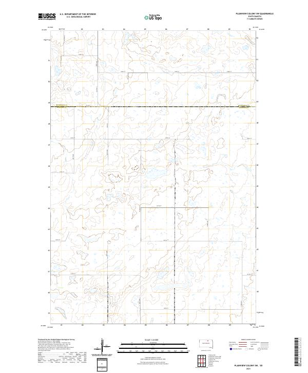
2021 Map of Plainview Colony SW
USGS Topo · Published 2021About this map
The boundary line between McPherson Co and Edmunds Co bisects this northern South Dakota landscape, defining a rural grid of township and range lines. The terrain is characterized by numerous small glacial depressions and wetlands scattered across the prairie. Access is provided by a network of sectional roads, including north-south routes like 349th Ave and 350th Ave, which intersect with east-west connectors such as 125th St. Local transport relies on county designations like Co Hwy 13 and Ed Co 14, reflecting the agricultural organization of the region. This 2021 study shows the persistent rectilinear layout typical of the Great Plains, where the land was systematically divided for settlement and farming.
Find a feature on this map
24 named features on this map. Tap any name to fly to it.
Don’t see what you’re looking for? This feature index may not catch every label — zoom into the map to look around manually.
Map Details
Editions of this 2021 Plainview Colony SW Map
This is the sole edition of this map. No revisions or reprints were ever made.
Other maps of this area

1954 · Aberdeen
USGS Topo · 1:250,000

1956 · Aberdeen
USGS Topo · 1:250,000

1974 · Roscoe
USGS Topo · 1:24,000

1978 · Beebe
USGS Topo · 1:24,000
1978 · Ipswich
USGS Topo · 1:24,000

1978 · Hosmer NE
USGS Topo · 1:24,000

1978 · Hosmer SE
USGS Topo · 1:24,000
1978 · Plainview Colony
USGS Topo · 1:24,000
1978 · Plainview Colony NE
USGS Topo · 1:24,000

1978 · Plainview Colony NW
USGS Topo · 1:24,000