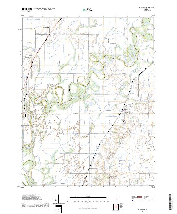
2022 Map of Plainville
USGS Topo · Published 2022About this map
The White River carves a complex, meandering boundary between Daviess and Knox counties, defining a landscape of low-lying wetlands and intensive drainage engineering. The river's serpentine path is paralleled by an intricate network of man-made waterways including the Singer, Linnewebber, and Pollard ditches, which reflect a long-term effort to manage the fertile but marshy bottomlands. Settlement is concentrated in the small communities of Plainville, Edwardsport, and Westphalia, each situated on slightly higher ground away from the immediate floodplain.
Find a feature on this map
80 named features on this map. Tap any name to fly to it.
Don’t see what you’re looking for? This feature index may not catch every label — zoom into the map to look around manually.
Map Details
Editions of this 2022 Plainville Map
This is the sole edition of this map. No revisions or reprints were ever made.
Other maps of this area

1943 · Lyons
USGS Topo · 1:24,000

1943 · Sandborn
USGS Topo · 1:24,000

1943 · Bicknell
USGS Topo · 1:24,000

1943 · Plainville
USGS Topo · 1:24,000

1943 · Epsom
USGS Topo · 1:24,000

1944 · Bucktown
USGS Topo · 1:24,000

1944 · Montgomery
USGS Topo · 1:24,000

1944 · Washington
USGS Topo · 1:24,000

1944 · Wheatland
USGS Topo · 1:24,000

1956 · Vincennes
USGS Topo · 1:250,000